Gurja (Khani)-Himal Trek the hidden village:

international Airport to Hotel,
Kathmandu Valley Sightseeing,
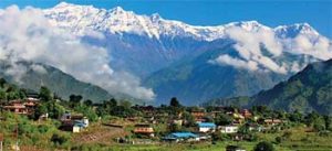
you will have majestic views of glorious Manaslu Peaks and the snow-capped Annapurna and Langtang Himalaya range. Or you can take a Tourist bus to Pokhara about 6-7 hour drive via scenic Prithvi Highway.
From Pokhara 5/7hr drive after Beni bumping road to Darbang,
Keep on the jeep road – in dusty or muddy in a few places but little traffic except for mule trains and there are stunning views of the Dhaulagiri range to compensate. The passes through woodland interspersed with terraced fields, where you will see villagers busy with different tasks depending on the agricultural season – ploughing, planting, harvesting,
Follow the only path down the north slope of the ridge. A landslide in the monsoon of 2014 felled many of the majestic Himalayan cedar trees and destroyed sections of the path. The path has been repaired and the landslide opened up views of Gurja Himal which can be enjoyed much of the way down. In December and January you may encounter snow on this section,
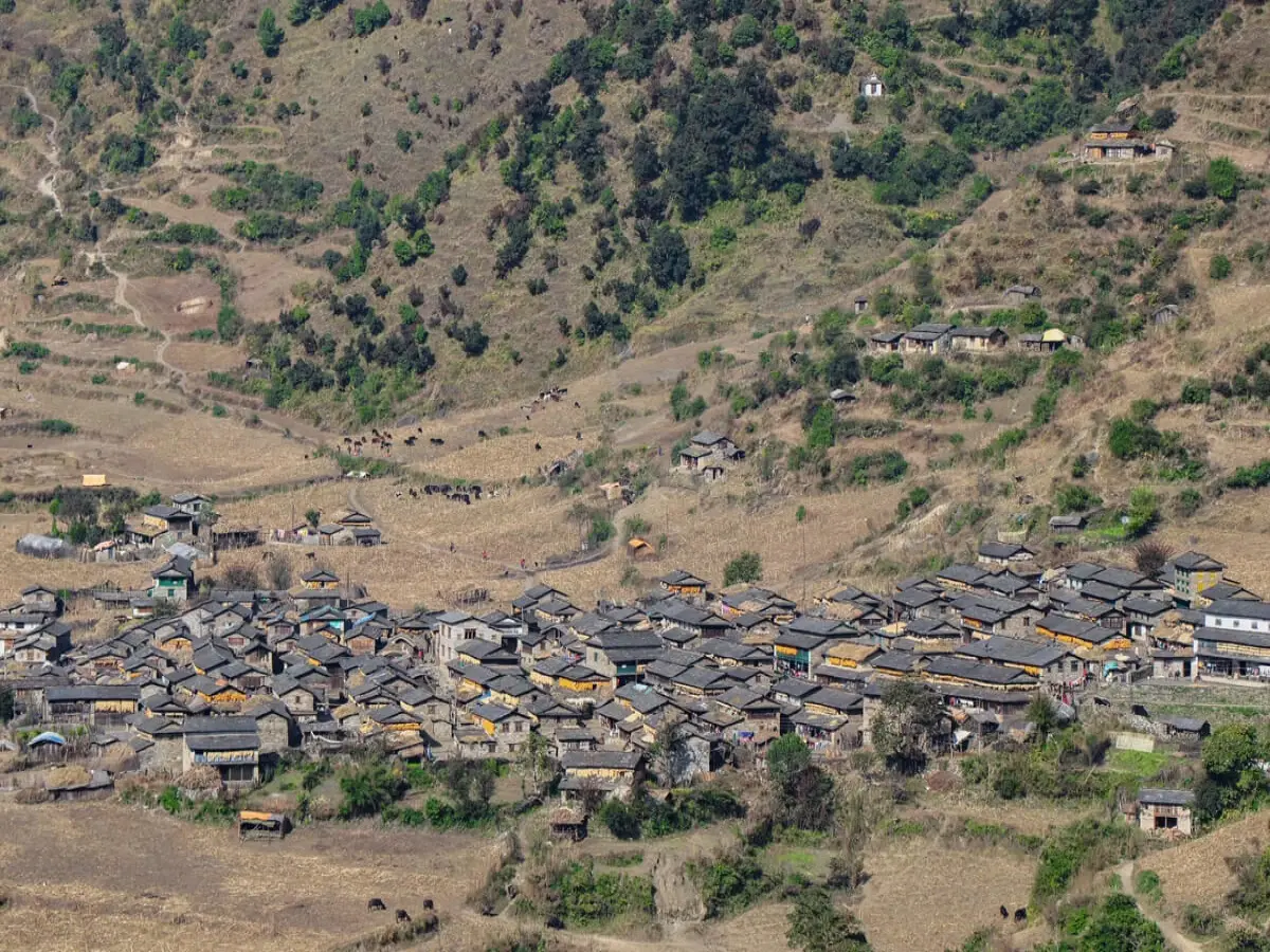
Rest In Gurja for exploring the village and local houses, Overnight local home Stay,
Back to same trail, 7hr walk, overnight local home stay,
Darbang or from Muna can catch the jeep from Muna to Pokhara directly, if would not like do trek to beyond the village 6/7hr walk, overnight Guest house, Altitude: 2450m,
By jeep 8/9hr drive, following Beni bazar or can follow Baglung Bazar, Overnight Hotel with B,B,
Exploring Pokhara heritage, Visit Pokhara as International Museum, Altitude: 850m, Overnight Same Hotel,
By flight or tourist bus, 25 minutes by flight, and by bus 7/8hr, Overnight 3 stars hotel with B,B,
Departure to International airport Kathmandu, for your return to home,
We welcome you and pick up you at airport; 30 minutes to drive from the airport to Hôtel. overnight 3 Stars Hotel with B,B
Visit by our private vehicle drop and pick during visiting monument of Kathmandu, Baudhanath, Pashupatinath, Bhaktapur, lunch break then back to Patan darbar square, Swayambhunath (monkey temple, and Kathmandu Darbar square, back to Hotel, overnight Same hotel with B,B
today we leave Kathmandu for your trip to Gurja Himal, Druring travel this day you will have majestic views of glorious Manaslu Peaks and the snow-capped Annapurna and Langtang Himalaya range. or if you are or want solo trek you can take a Tourist bus to Pokhara via scenic Prithvi Highway. edge of the rivers Trisuli, Marshyangdi, Seti Gandaki near arrive Pokhara, Over night 3 Stars Hotel with B,B
After beni Bazar bumping road to Darbang, Darbang, located in the Malika Rural Municipality of Myagdi District, Nepal, sits at an approximate elevation of meters (3707 feet) above sea level. It serves as a key Dhaulagiri trekking point along the Myagdi Khola before ascending to higher altitudes. Overnight guest house with B,D,B
Keep on the jeep road – in dusty or muddy in a few places but little traffic except for mule trains and there are stunning views of the Dhaulagiri range to compensate. The passes through woodland interspersed with terraced fields, where you will see villagers busy with different tasks depending on the agricultural season – ploughing, planting, harvesting, or threshing. In about an hour you arrive at the even more picturesque village of Takam – slate roofs, stone walls, front façades of white and ochre mud plaster, and a small pagoda temple sitting on a wide crescent of rice fields with an unbelievable backdrop of snow mountains. Just before Takam, take the lower right fork in the track (shorter, and less dusty) which leads past a stone tap water spout. Homestay accommodation is available here as well as teashop-lodges. Continuing, follow the jeep track as it climbs to negotiate a landslide-prone cliff section and winds around to reach Sibang (1790m) in 30 minutes jeep track ends here (Dec 2014). Accommodation is available in teashop-lodges. Follow the footpath which continues and in about 15 minutes take the upper fork which climbs up to pass near the lower part of Machim village (the lower fork descends to cross the river for the Dhaulagiri Circuit route) from where there are good views up the valley which leads to French Pass. From here the trail is level to the school at Phalegaon (teashops and local accommodation available.)
3 Hours walk takes us to Lulang village (2410m) via Phalegaon. Phaegaon the path descends gently (passing below the village of Muna) to reach a bridge across the Dar Khola (tributary of the Myagdi) in less than an hour. Looking westwards upstream the villages die out and the mountains rise higher and steeper, ridges intersecting each other like a fat braid of mountains. Across the river there is a single teashop (can't be relied upon to be open it is a longish climb to the next teashop at Lulang). Just past the teashop there is a choice of trails. The lower (left) trail keeps closer to the river and climbs gently to reach Lumsung village (in Lulang VDC) while the upper right trail climbs steadily to the large and fascinating village of Lulang. The 30 latter is the more direct trail which you should take (unless you are heading to the Jaljalla Pass and Dhorpatan). At Lulang there is one local lodge about halfway up on the left friendly but very simple homestay accommodation further up and further left at Kali Maya’s though the room is very small the toilet is spotless. Further homestays are anticipated in the coming year. [If you are too tired to climb the steep stairs to Lulang is possible to stay at teashop lodge at Lumsung. The next day there is a direct path between Lumsung and Lulang. ovenight local home, with B,D,B
Track any footpath up through Lulang to reach the main trail which emerges from the village on the upper left side as you look uphill. Once on the trail it is impossible to lose the way since the route is well travelled by mule trains. You are also certain to be accompanied by women heading out with empty basket of Bamboo on their back to gather firewood and fodder. It is a pleasant climb through oak-rhododendron forest – not too steep except for the final section. The branches and trunks are almost hidden by a thick cloak of moss, ferns, and orchids. At the pass there is a draughty teashop (tea, noodles, biscuits) and stupendous views of Gurja Himal – if you arrive before noon. Follow the only path down the north slope of the ridge. A landslide in the monsoon of 2014 felled many of the majestic Himalayan cedar trees and destroyed sections of the path. The path has been repaired and the landslide opened up views of Gurja Himal which can be enjoyed much of the way down. In December and January you may encounter snow on this section (in 1998 our children sledged most of the way on their bottoms). After descending moderately steeply, the gradient lessens as the path heads in a more Lulang Village Lulang is an unusual village because all of its 200 households belong to the dalit caste of metal-workers (Kami). Fanned around a steep stadium of terraced fields, the village is colorful with marigold flowers, rows of pumpkins and maize drying on roofs and verandahs, the houses decorated with splashes and stripes of red, white and black muds. It is however a very poor and neglected village, with a high rate of absentee men who have gone to seek their fortune in the Gulf countries. 31 31 westerly direction for the final hour of the descent to the bridge over the Dhaula Khola. On the opposite side you will see fields and temporary dwellings of the Gurja
people, who descend to live in these when snow falls up in the village. There used to be a wooden bridge spanning the narrowest point of the gorge, but in the past year a modern suspension bridge has been installed. The last leg to the village involves another climb. It is not so high but it is steep and has to be done when legs are tired. Follow the main track upwards. By this hour you are likely to encounter villagers heading home with farming tools or loads of firewood and grass on their backs, so there is no risk of getting lost. The path arrives at a flattish grassy meadow. There is a water tap and an empty building on the right, with the sheer face of Gurja Himal partially visible
above the village of Gurja Khani is also visible to the left and is reached on a level footpath in about 15 minutes from here. Near the village, avoid the path which forks right and rises up to the school. Overnight local homestay, With B,D,B
For exploring the village and local houses of Gurja Khani, Overnight local home Stay, Overnight with B,D,L,B
Back to same trail or today we going to leave of Gurja Village, if good weather wee have to admire the mountains Gurja, Dhaulagiri range during the way to back, overnight local home stay,
Trek to beyond the village and river Myagdi river, walk rice field and millets, maize, or can catch the jeep from Muna to Pokhara directly, if would not like do trek to Darbang Village, overnight Guest house,
Today we going to leave Myagdi region following Beni bazar or can follow Baglung Bazar, up to Beni Bazar Bumping road to drive, Overnight Hotel with B,B,
Today we exploring Pokhara heritage, International Museum, Altitude: 850m, Overnight Same Hotel,
By flight or tourist bus, or Private vehicle 7/8hr, Overnight 3 stars hotel with B,B,
3 Nights hotel in Kathmandu with (BB)
•2 night hotel in Pokhara with (BB)
•Dhaulagiri-Annapurna Conservation Permit fees
•All meals during the trek (Breakfast, Lunch & dinner)
•Staff: 1 Experience trekking Guide, necessary porters
•Local transportation Airport – Hotel – Airport. Kathmandu-Beni-Darbang or can catch from Muna, Pokhara Transfers Kathmandu staff transfers,
•Life and medical insurance for Nepali staff
•Trekking allowance, food allowance for trekking staff.
•service charge
Government Tax
•Personal equipment during the trekking
•Personal Insurance for travel to Nepal
•Lunch & dinner in Kathmandu & Pokhara
•Emergency Rescue evacuation if required (Helicopter)and Horses,
•Personal expenses
•Bar bills, mineral water and single rooms
•Phone calls, laundry
•Entrance fees for monastery/ museum
•Tips for guide & porters
Guaranteed - Trip is Guaranteed to run
Available - Trip is available to run if minimum group size is filled
Limited - Only few space available
| Trip Start Date | Trip End Date | Price | Avability | Book |
|---|

Mount Dhaulagiri one- 8163m, Annapurna Range, Mnt Nilgiri north, Mnt Sita Chuchura 6611m, Mnt Nilgiri 6940m, Mnt Thapa Peak 6015m, Mnt Tukche Peak 6920m, Mnt Tilicho peak 7134m
 Trip Code:
  Destination:
  Trip Grade:
  Max Elevation:
  Total Duration:
  Best Time:
  Group Size:
I did Dhaulagiri Trek in 20 September to 7 October 2018, we were 8 person a group, Thank you so very much for a most spectacular trip. I also appreciate your heartfelt concern when I wasn't feeling so well the night you took us out to dinner. I will always wish that you continued success with your wonderful and most organized company. Without a doubt, I would recommend Himalayanrandonner to anyone + everyone. The personal quality is outstanding. Thank you once again for everything.

We had The best experience with Himalayanrandonner Guide it was Very helpful with putting together a tour and trekking after our needs. Great service before we got there, and all the way. Guide and his staff are the best. We recommend this agency to everyone. We would choose them again. Personal, Professional, Friendly and Service minded.

It was the first time in Nepal, It was trek in 8 March 2018.
We booked a trekking trip to Manaslu circuit by mail. Kas Gurung has been really kind from the beginning. He always answered firstly to our questions and adjusted the journey basing on our needs and requests. Everything was organized perfectly. The whole team was somewhat more than professional. They were also really friendly and helpful in every situation.
Special thanks to Guide for his excellent work which has allowed us at all times to feel comfortable. Always smiling, guide! The love for his country and culture was contagious! showing us beautiful places and curiosities of Nepali lifestyle. We absolutely recommend him as an experienced guide and as a great friend,

We did Khopra Hill Trekking Annapurna 13 days. in 8 February 2017, It is fantastic view point and beautiful forest and peoples, Good guide and service mind assistance guide and porters. Our group has booked with this agency many times for our visits. We are happy with them. and his team can support you. We will definitely book next trip with them too.


